

M’sian Developed AR LRT Map Which Appears On Your Touchn’ GO Card
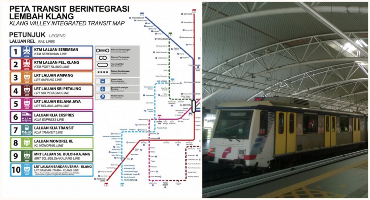
We all know that as our LRT line becomes more and more advance, sometimes you might face problems such as don’t know where or which colour line you should be following especially when you are at the main hub station. Where there will be all the line of different route coming together.
However, a smart Malaysian seems to have made a great solution after he himself find that it is difficult to follow the colour route sometimes so he created something smart. @emlshfy noticed this difficulty as he mostly uses the LRT to commute home from work. In his words, the process is “time-consuming” since he has to either search up the picture of the map from his phone gallery or go online to the RapidKL map in order to plan where he’s going.
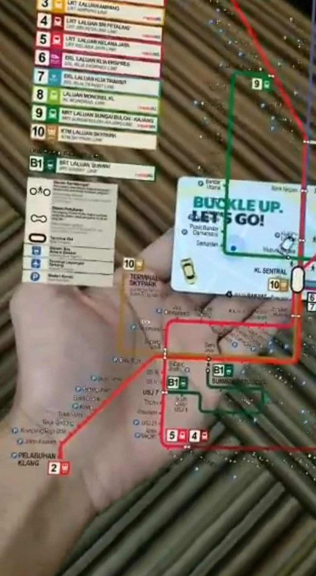
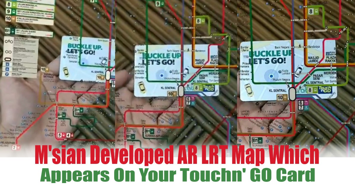
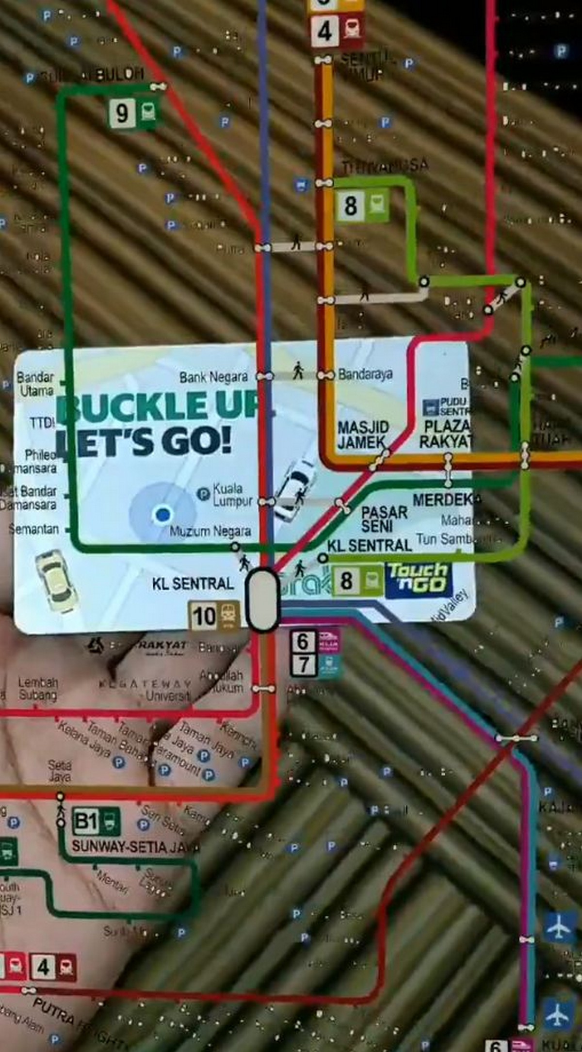
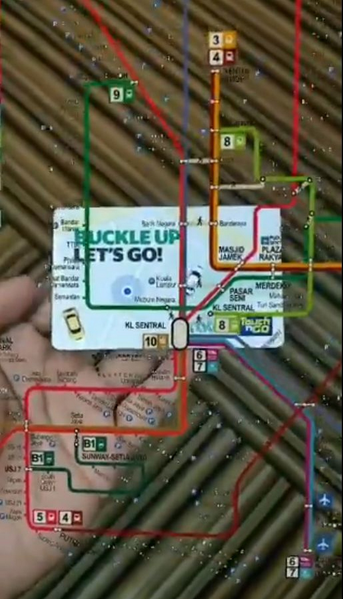
Using his skills in web development, Emil configured an AR (Augmented Reality) rendering of the LRT map that activates once you scan your Touch ‘n Go card using your smartphone. The feature looks cool and futuristic as heck and will surely help out a tonne of Malaysians whenever we’re in a hurry at the LRT (which is almost all the time). Since the scanner is still in its beta stage, Emil plans to add plenty of other cool updates, including an interactive feature, before he releases it to the public.
At the moment, he plans on collaborating with other creators in order to realise this innovative addition to the way we use our Touch ‘n Go cards.
Made an LRT map appear on my Touch N Go card in AR. Woohoo! still a bit buggy but helpful if we're ever lost pic.twitter.com/ynZKEaA4WQ
— emil (@emlshfy) August 17, 2020
image source